You are on Darling Street in Balmain, you can see a stop across the road, and you have no idea what it is called. In KRAIL you do not need the name. Open the map, tap the stop, and use it.
Tap Select on map
Tap Starting from or Destination like you normally would, then tap Select on map. A map opens with stops dotted all over it.
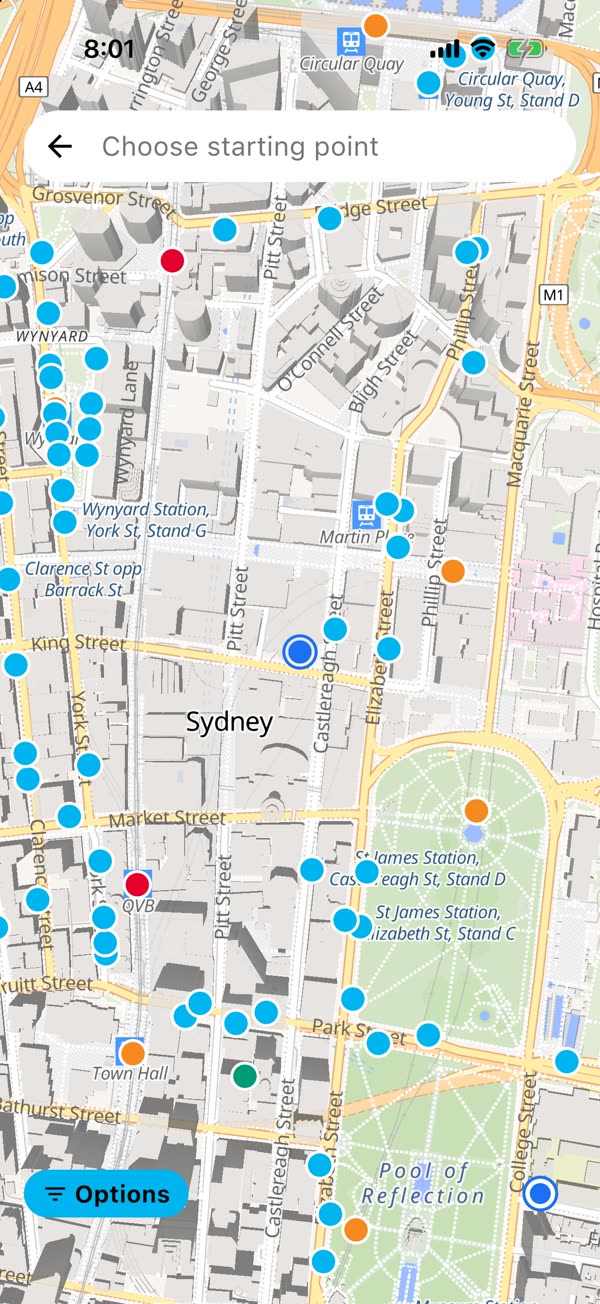
The first time, KRAIL shows you Map Options, which is where you set up what the map shows. You can choose:
- how far to look, 1 km, 3 km or 5 km
- which stops to show: trains, metro, buses, light rail, ferries and coaches
Only want ferry wharves? Switch the rest off, tap Save, and the map gets a lot less busy.
Tap a stop and see what is leaving
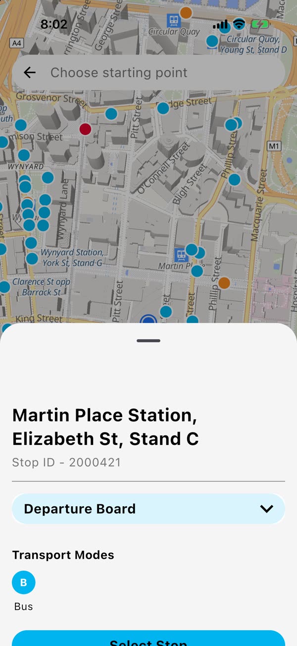
Tap any stop and a card slides up with its name. Tap Departure Board on it and you can see what is coming before you even pick it. Happy with it? Tap Select Stop and it goes straight into your search.
Show where you are
Tap to share your location and the map jumps to you. KRAIL only asks for your location when you tap to share it, never on its own. Say no and the map still works, it just starts in the city.
Good to know
- The stops are stored on your phone, so the dots show up fast. The map itself needs a data connection to draw the streets.
- This is handy for places you have never been: a mate's new suburb, a stadium, a beach you are catching a bus to for the first time.
Save your trip once.
The next departure is one tap away, every morning.